
Description
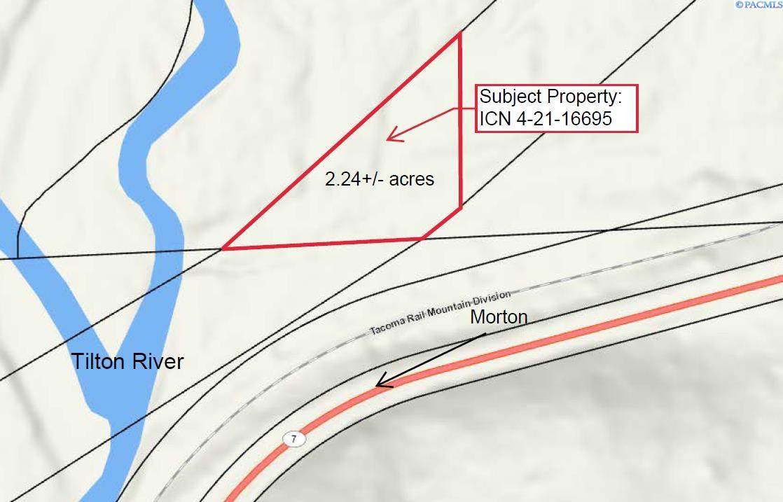
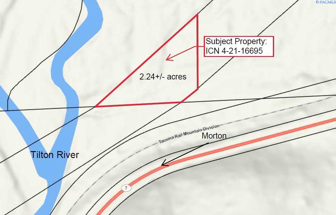
MLS# 291297 The parcel is zoned RDD-10 by Lewis County. (RDD-10, which permits 1 residential house per every 10 acres. A 2.24+/- acre trapezoid shaped parcel that is located in a rural area of Lewis County, along SR-7. Parcel is land locked with no legal access. The subject site is wooded with various vegetation and is 15%-35% slope and lies within a 100-year flood plain and is affected by the shoreline stream from the Tilton River. No utilities on site. All standard utilities are available in the area, but will need to be extended to parcel when land is developed.
-
0BEDS
-
2.24ACRES
-
0BATHS
-
01/2 BATHS
School Ratings & Info
Description
MLS# 291297 The parcel is zoned RDD-10 by Lewis County. (RDD-10, which permits 1 residential house per every 10 acres. A 2.24+/- acre trapezoid shaped parcel that is located in a rural area of Lewis County, along SR-7. Parcel is land locked with no legal access. The subject site is wooded with various vegetation and is 15%-35% slope and lies within a 100-year flood plain and is affected by the shoreline stream from the Tilton River. No utilities on site. All standard utilities are available in the area, but will need to be extended to parcel when land is developed.
© 2026 Pacific Regional Multiple Listing Service. All rights reserved. IDX information is provided exclusively for consumers' personal, non-commercial use and may not be used for any purpose other than to identify prospective properties consumers may be interested in purchasing. Information is deemed reliable but is not guaranteed accurate by the MLS or Keller Williams Tri-Cities. Data last updated: 2026-10-17T12:39:51.883.